
The Basics: What “Relief” Actually Means
The word comes from the French bas-relief — a sculptural technique in which forms project outward from a flat background. In a city relief map, that background is a wood frame, and the forms projecting from it are the streets, districts, parks, and topographic contours of a real city. It is not an illustration, not a photograph, and not a diagram. It is a physical representation of a place, accurate to the underlying geographic data.
Where a traditional map communicates through symbols and labels, a 3D city relief map communicates through shape. You read it with your eyes and, if you choose, with your fingertips. Run a finger along a river valley and you feel it dip. Trace a ridge line and you feel it rise. This tactile quality is what separates a relief from every other form of cartographic representation.
The tradition of relief mapping has deep roots. Military cartographers produced terrain models for centuries — Napoleon’s generals used them to plan campaigns, and the Swiss Federal Office of Topography has maintained a collection of exquisite terrain models since the eighteenth century. What has changed is the technology. Where those historical models required months of painstaking hand carving, modern 3D printing allows us to produce geographically accurate reliefs from digital elevation data in a fraction of the time.
From Topographic Data to Finished Object
Every Urban Frames piece begins with geographic source data — the same open elevation datasets used by urban planners and cartographers. These datasets are derived from satellite measurements, LiDAR surveys, and topographic mapping programs that capture the earth’s surface with remarkable precision.
That raw data is processed into a 3D model that captures the elevation, street layout, and district boundaries of the city. Nothing is invented. The hills of Edinburgh are there because Edinburgh has hills; the flat grid of Singapore is there because Singapore’s central area is flat. The curve of the Vltava through Prague, the park lakes of Bucharest, the Arno cutting through Florence — all of these features appear in the relief because they exist in the real topography.
The data processing stage is where cartographic decisions are made. Vertical exaggeration is applied — meaning the elevation differences are amplified slightly — so that the topographic features are legible at the scale of the finished piece. Without this exaggeration, a 23 cm relief of a relatively flat city would show almost no perceptible elevation change. With it, the subtle rises and depressions that define the city’s character become visible and tactile.
The model is then printed using biodegradable PLA — a corn-starch-derived polymer that is rigid, precise, and takes fine surface detail well. PLA is derived from renewable resources, primarily corn starch, and has a significantly lower environmental footprint than petroleum-based plastics. It is also dimensionally stable, meaning it does not warp or shrink over time — an important quality for an object intended to be displayed for years or decades.
The printed relief is mounted into a sustainably sourced wood frame, cut and finished by hand in our Bucharest workshop. Depending on the finish you choose, the frame can be natural wood (revealing the grain), black, or white. Each piece is inspected before shipping to ensure the detail is crisp and the mounting is secure.
The process from order to dispatch typically takes two to four working days.
Three Sizes, Three Purposes
Urban Frames city reliefs are made in three sizes:
- 11 cm (Compact) — Suitable for a desk, a bookshelf, or a small section of wall. Popular as a gift that travels easily. At this scale, the overall form of the city is immediately legible — the river, the major boulevards, the parks — though the finest street-level detail requires a closer look.
- 23 cm (Detailed) — The most widely ordered size. It works as a standalone wall feature in a living room, bedroom, or office without dominating the space. At 23 cm, the balance between overview and detail is optimal: you can read the city’s overall form from across the room and trace individual streets when you step closer.
- 50 cm (Collector) — The statement piece. At this scale, the topographic detail becomes fully legible from across a room. Individual blocks, parks, and waterways are clearly defined. Best suited to larger walls or dedicated display positions — above a fireplace, in a hallway, or as the centerpiece of a gallery wall.
Each size is proportionally scaled from the same model, so the 50 cm and 11 cm pieces show the same geographic area — the larger format simply has more visible resolution.
The Role of Light
One quality of a 3D city relief that photographs cannot fully convey is its interaction with light. Because the surface has physical depth — streets that are lower, ridges that are higher, parks that sit in slight depressions — the piece changes appearance throughout the day as the angle and intensity of ambient light shifts.
In morning light from a side window, the shadows are long and the topographic features are strongly defined. Under direct overhead light, the piece appears flatter and the overall urban grid becomes more prominent. In soft evening light, the contours deepen and the city takes on a quality that feels almost alive.
This is not a designed effect — it is simply what happens when a three-dimensional object interacts with natural light. But it means that a relief on your wall is never quite the same twice, and people who live with one often notice new details months after hanging it.

Who Orders Them and Why
The short answer: anyone with a meaningful connection to a city.
The more specific answer:
People who grew up in a city and no longer live there. A 3D relief is a way to maintain a physical relationship with a place when regular visits are no longer easy. Edinburgh has a large global diaspora. So does Bucharest. For these customers, the relief is not decorative — it is emotional. It is the streets they walked to school, the park where they played, the river they crossed every day.
Travelers who want something that cannot be bought at an airport. A relief map of Prague is not a souvenir available at Charles Bridge gift shops. It is specific, considered, and made to last. It carries the weight of the place without the kitsch of a mass-produced trinket.
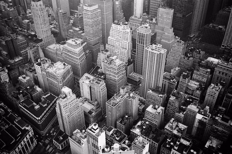
Architecture and urban design enthusiasts. The relief makes urban form legible in a way that plan-view maps and aerial photographs do not. Seeing a city’s street grid and topography rendered in three dimensions changes how you understand it. You begin to see why certain neighborhoods developed where they did, why a river bend created a natural focal point, why a hill attracted a fortress.
People looking for a gift that is genuinely personal. A 3D city relief tied to a specific place — where someone was born, where they met their partner, where they studied — communicates something a generic gift cannot. It says: I know this place matters to you.
Interior designers and architects. A relief adds texture and dimension to a wall composition in a way that flat prints cannot. The interplay between the relief and other framed pieces creates visual interest that purely two-dimensional arrangements lack.

The Six Cities Currently Available
Urban Frames currently produces reliefs for six cities, each chosen for its distinctive topographic character:
- Edinburgh — volcanic topography, medieval closes, one of the most geographically dramatic capital cities in Europe. The castle on its volcanic plug, Arthur’s Seat, and the ridge of the Royal Mile create a skyline that translates beautifully into relief.
- Florence — the Arno river, Renaissance grid, and surrounding Tuscan hills. The compact historic center, the bridges, and the gentle rise toward the Oltrarno make Florence one of the most satisfying cities to render in three dimensions.
- Prague — the Vltava curve, Hradcany heights, and the dense medieval core of Stare Mesto. The dramatic elevation difference between the castle district and the river gives the Prague relief a striking profile.
- Oslo — fjord geometry and the forested ridges that define the city’s character. The contrast between the dense harbor area and the natural terrain surrounding it makes Oslo’s relief particularly compelling.
- Singapore — the dense urban core of Marina Bay and the central business district. Singapore’s relatively flat terrain is offset by the intricate density of its street grid, which creates a texture unlike any European city in the collection.
- Bucharest — the Romanian capital, with its park lakes, boulevard geometry, and the civic axis of Unirii. As our home city, Bucharest is the relief we know most intimately, and its blend of green spaces and urban density creates a distinctive pattern.
New cities are added based on demand. If the city you are looking for is not yet available, it is worth checking back or reaching out directly.
How It Compares to Other Wall Art
A 3D city relief occupies a space between traditional wall art and sculpture. It hangs on a wall like a framed print, but it has physical depth like a sculptural object. This hybrid quality is part of what makes it distinctive in a room.
Compared to a framed photograph or poster of a city, a relief offers tactile engagement and the play of light and shadow. Compared to a traditional framed map, it offers dimension and geographic accuracy without the visual clutter of labels and symbols. Compared to abstract wall sculpture, it offers specificity — it is not an arbitrary form but a real place, legible to anyone who knows the city.
A Note on What It Is Not
A 3D city relief map is not a navigation tool. It does not have street names or address markers. It is not interactive, and it does not connect to any data service.
It is a physical object that represents a real place with geographic accuracy. That is its purpose, and it does that purpose well.
If you want to understand what a city looks and feels like as a landform — its hills, its river bends, its dense cores and open parks — a 3D relief shows you that in a way no flat map or screen can. It is geography you can hold in your hands.
Take this feeling home
Frame the memory before it fades
Choose a handcrafted relief frame to keep this story on your wall.